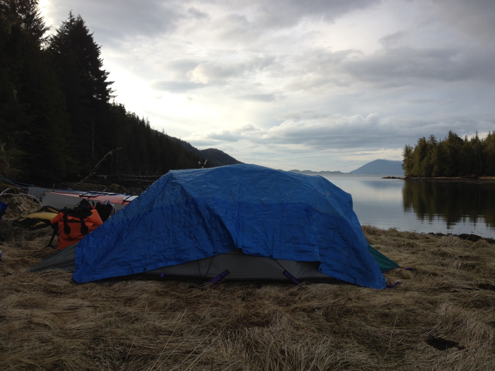
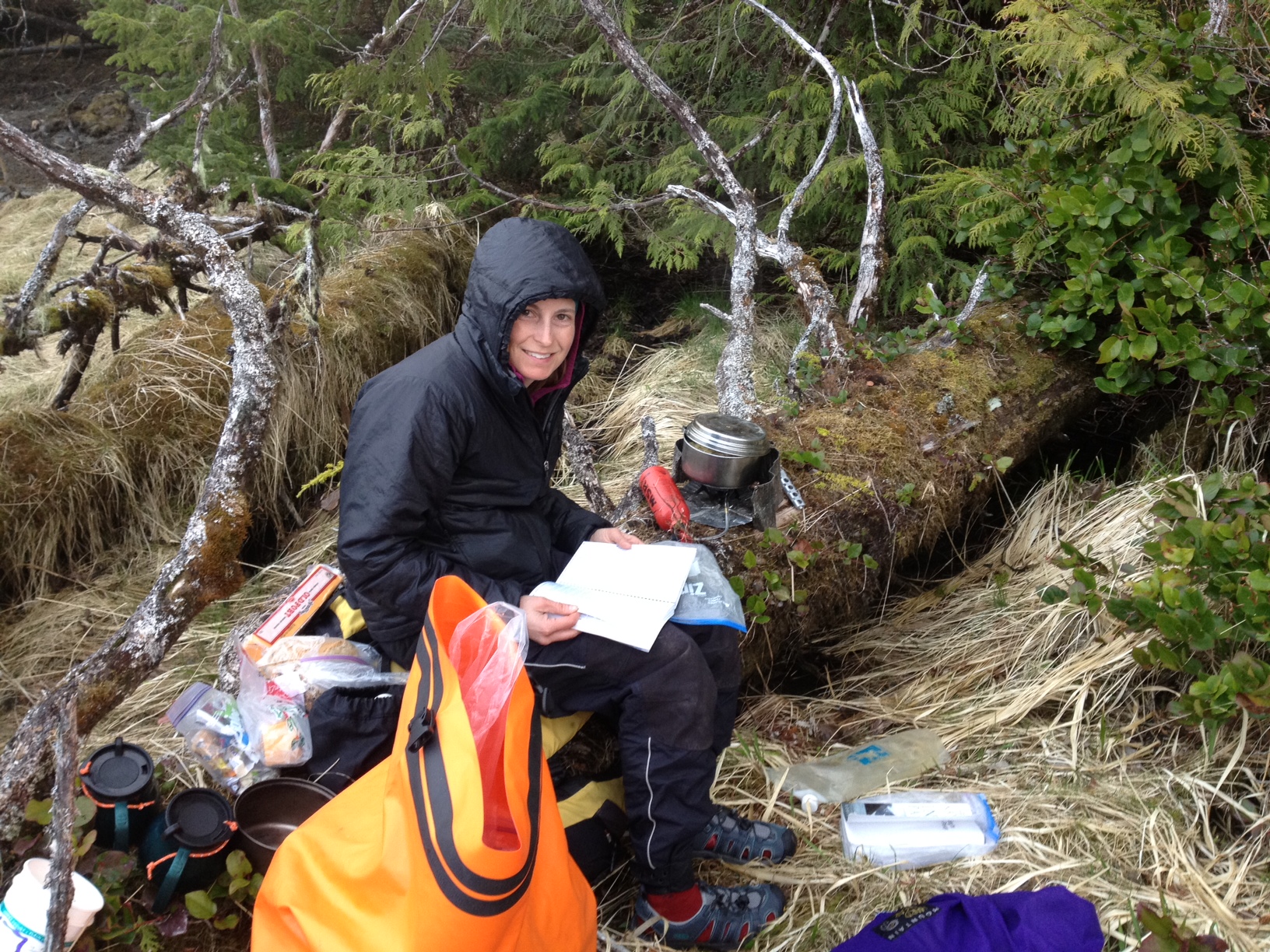
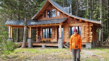
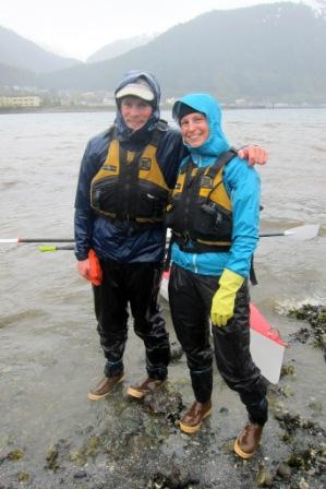
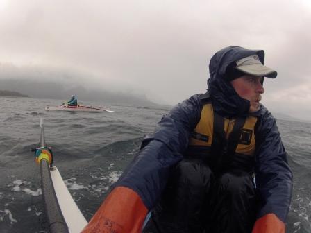
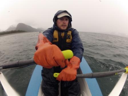
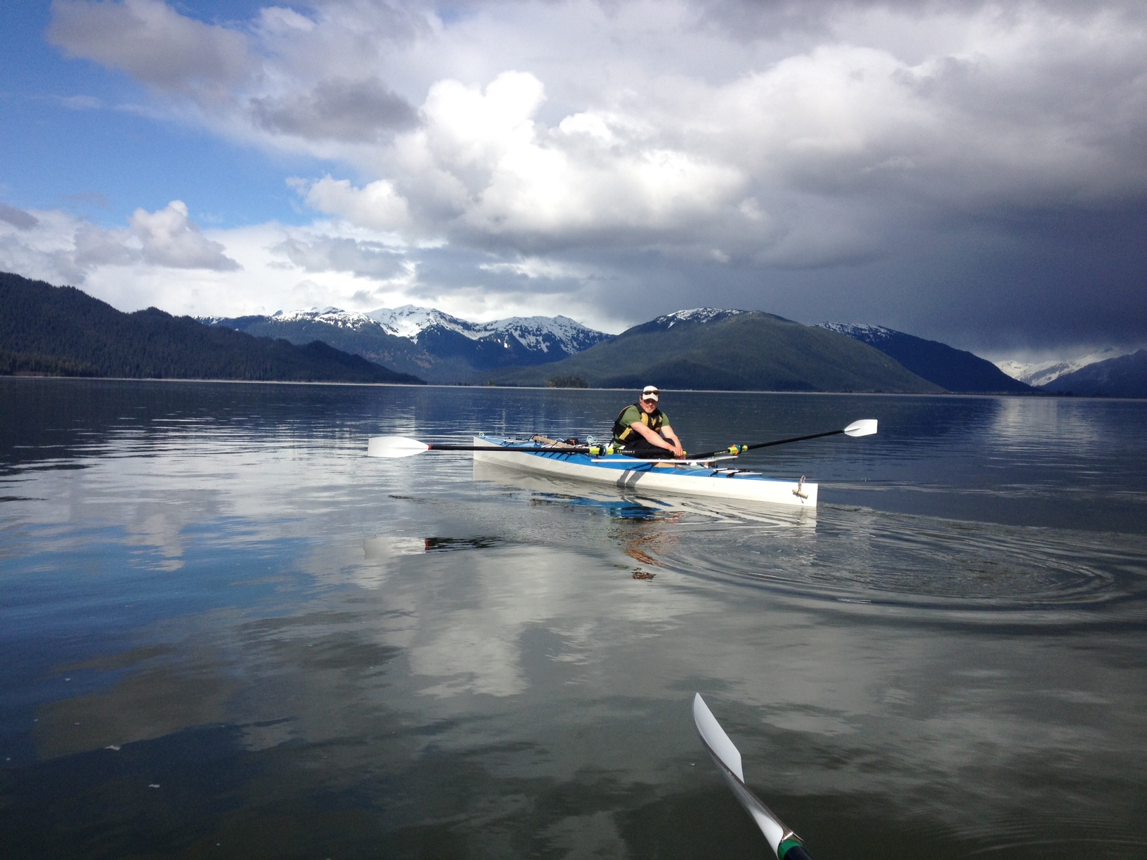
The final leg to our cabin near Haines brought both too much water and too little. In a driving rainstorm several miles outside of downtown Juneau we found ourselves dragging the boats through Gastineau Channel, gone dry at low tide. In the frenzy of final packing and logistics and with only a couple of hours of sleep, we neglected to think about much for the day besides getting back on the water. Fortunately the tide did its usual reversal and before long we were floating in the boats and able to continue on our way. The next couple of days brought more water than we wanted to deal with, in the form of rain squalls and whitecaps. We happily arrived at our cabin in northern Lynn Canal yesterday evening under heavy rain and gusty southeasterly winds, and one of the worst surf landing we’ve dealt with yet. We cut our seafaring teeth on Bellingham Bay and have since scared the pants off ourselves many times in Lynn Canal. Linking these two bodies of water offered a new perspective on each, and on the nearly 1,200 miles between. We lived on a 27’ sailboat while attending Western Washington University in Bellingham and clumsily learned about winds and tides on forays around the San Juan islands. A boating class at the local community college taught us the difference between port and starboard, and how to read channel markers and current atlases. In the summer between my first and second year of graduate school, we made our way to the north end of Vancouver Island, detouring up Bute Inlet to climb Mt. Waddington along the way. After motoring up the glacially-fed Homathko River, we left our boat at a logging camp. We struggled through the dense brush of temperate rainforest to reach the extensive icefields and jagged peaks above. This journey in the Coast Mountains of British Columbia instilled in both of us a love for landscapes where mountains meet the water. We first visited Glacier Point on a short kayak trip outside of Haines the following summer. Camping on what is now our beach was enough to send us zooming back to town to make an offer on the 30+ acres of remote coastal property. After three seasons of felling trees, scribing and stacking logs, and milling boards, we were ready to move into our cozy, 700 sq ft log cabin. Building and living remotely has presented plenty of challenges, boating being one of the most persistent and stressful. Lynn Canal is the most familiar body of water on the entire Inside Passage, but it is also one of the most intimidating. Crossing the Chilkat Inlet to Letnikof Harbor in Haines is always a slightly daunting proposition. Though only a nine mile boat ride, this glacial fjord kicks up chop at the slightest breeze and happens to be one of the windiest places in southeast Alaska. Transporting supplies, visitors, and ourselves only happens at the whim of the winds and water, usually accompanied by slightly frayed nerves. We have been left stranded on one side or the other for days at a time when the seas are too rough for our 16’ skiff. Capsizing a kayak taught us early on about the seriousness of this crossing. Other days the glassy water feels like a lake, and hauling sheets of plywood, a 500 gallon water tank, and other unwieldy cargo is a breeze. Soaked to the bone after a wet day in 20 knot winds and temperatures in the high 30s, we delighted in warming up by the woodstove and drying out gear last night. Glacier Point is a dynamic and lively place, with jagged peaks, fierce winds, and a productive coastal rainforest. Winter storms rearrange the beach margins at will, creating an ever-changing shoreline. A picturesque tidal lagoon provides a stopover for migrating birds—this morning we watched dowitchers, plovers, dunlin, whimbrel, teal, pintail, and mallards feeding and roosting. A fresh moose carcass, perhaps the product of abundant wolves in the area, lay in the grass nearby. These all serve as reminders that our arrival is only one of the many comings and goings here. Leaving Bellingham in a hailstorm and arriving in Haines to snow along the shorelines, it feels like we’ve been chasing spring on its slow passage north. With unseasonably cool temperatures, the surrounding peaks are plastered with fresh snow and leaves are only barely starting to emerge. This backward progression of the seasons will continue a bit longer as our next leg of the trip takes us up and over the mountains. We plan to packraft across to the east side of Lynn Canal with ski and glacier travel gear. We’ll climb through treeline to the prominent col near Mt. Sinclair that we see from our cabin window. We’ll then travel over the Mead glacier that leads into Canada. From there we will drop down into Tagish Lake (Taku Arm) and packraft its 110 mile length to Whitehorse. If all goes according to plan, that is!
Inside Passage
Inside Passage photos /
We updated the Photo Gallery with new images of rowing from Bellingham to Juneau. You can find them here.
Juneau /
We arrived in Juneau last night after another miserably wet, windy day of rowing. Besides a humpback that surfaced very nearby, we couldn’t see much through the fog and our tightly cinched hoods. But with a fierce tailwind, we made good time and covered 35 miles in 9 hours. By the time we’d reached Gastineau Channel, the rain and wind eased for a smooth ride to town. Spotting our friend Colin waiting to greet us at the Douglas Island bridge with his camera and a six pack was a very welcome sight! Perhaps fittingly, we rode out the “home stretch” to Juneau in day after day of wet, cold, often stressful, and sometimes scary conditions. Leaving Petersburg and entering Fredrick Sound, we enjoyed being dry for a couple of hours before the rain started in earnest. By mid-afternoon our Goretex paddling pants had lost the battle with this steady deluge and heavy fog shrouded the shorelines. As winds began to pick up from the east, we tucked into a nearly perfect campsite with a steep, gravel beach protected from the surf. We ate a quick pasta dinner before jumping into our sleeping bags to listen to the wind rush through the stalky hemlocks. The winds continued through the night, and by the time we’d finished breakfast the next morning, we looked out on a sea of white. This junction of Fredrick Sound, Chatham Strait, and Stephens Passage creates a big body of water with significant fetch so even moderate winds can churn up lots of chop. But it’s often hard to tell how rough the water is until sitting in it, especially from a protected vantage point, so we packed up the boats and headed out. The waves grew more intimidating as we blew further from the protection of the peninsula and fortunately we were able to find a beach nearby and land without too much surf. As the wind continued to howl, we set up the tent and called it a day, only 1.7 miles from our last camp. Darn.
The next morning looked promising—wet again, but calm when we left camp, and we hoped to make up a few lost miles. Not to be. The wind changed direction and started to pelt us from the north as we rounded Cape Fanshaw into Stephens Passage. Painstakingly slow progress as we fought the stiff headwind for the next 10 hours. Our wet laps weren’t helped by the occasional wave sloshing into the cockpit. Finally, the winds eased and we enjoyed several glorious miles of rowing on flat water before dark. Low lying clouds, fog, and mist created surreal conditions with the illusion of birds, porpoises, seals, and whales floating without a discernible horizon, sea and sky merging into one.
Still 70 miles out from Juneau, strong winds and rain continued, though thankfully the wind direction changed in our favor. We surfed along the mainland coast past Tracy Arm and hanging glaciers. We spotted more whales, a small brown bear, a beaver (oddly swimming along the shoreline), plus lots of scoters, gulls, guillemots, murres, harlequins, goldeneyes, mergansers, and murrelets. Abundant krill and herring, sometimes visible from our boats, created a feeding frenzy everywhere we looked. Unfortunately the clearcuts that persisted from Prince of Wales island, past Ketchikan, Wrangell, and Petersburg also scar many of the slopes in this area. Powerlines running from the giant hydroelectric source in Port Snettisham travel more than 20 miles along incredibly rough terrain and cross several channels and inlets to provide the bulk of Juneau’s electricity.
The first Arctic Tern of the trip swooped over as we neared Juneau—a sure sign of spring! After arriving, we enjoyed pizza and a comfy night at Colin and Amanda’s. Colin gave us the tour of his house project on Starr Hill, which Pat designed and is currently under construction. We now plan to take a short break from rowing to visit our new nephew and finalize logistics for the remaining legs. We’ll then take the rowboats the last 80 miles to our cabin near Haines in northern Lynn Canal. From there, we will head over the mountains and across Taku Arm to Whitehorse by ski and packraft. Stay tuned for Inside Passage photos, which we’ll post soon.
40 miles to Juneau /
After several hard won days we crossed the first thousand mile mark. We are now camped less than 40 miles from Juneau and hope for gentle winds for the home stretch tomorrow.
925 miles in /
From Pat Rays of sun sliced through billowing dark cumulus clouds as we rowed by the mouth of the Stikine River, a major waterway to the interior. Flocks of hundreds of shorebirds took off and turned in unison, resembling mist rising from the water. Sea lions hauled out on a rock outcrop growled and belched in the distance. We passed over tidal flats that dry completely at low water and entered Fredrick Sound with icebergs floating like large ships on the horizon.
We pulled into Petersburg today for our 3rd food resupply. The proximity of the Le Conte glacier is what allowed this town to thrive in its early days as ice was a valuable commodity for packing and shipping fish to southern markets. Unfortunately a thick layer of rainclouds hid the Devil's Thumb from view as we rowed past. An early sketch of this trip more than 2 years ago entailed making an attempt to climb one of the routes on this infamous rock that thrusts out of the Stikine ice cap. The peak boasts the largest face in North America, rising 6,700', twice the size of El Capitan in Yosemite. Its sheer size combined with foul coastal weather that plaster the mountain with snow and ice has left this northwest side unclimbed, though many of the world's greatest mountaineers have attempted it.
The peak was similarly socked in when I rode the ferry south with our spruce bark canoe in 2002 and Caroline likely doesn't remember it when she was here as a toddler while her civil-engineer dad was underground trying to resolve Petersburg's wastewater problems. (You'll have to ask Willy for details, but he figures their first problem was the fact that the sewage treatment plant was built uphill from town!)
Now 42 days and 925 miles into the trip we are becoming accustomed to the boats and falling into a steady rhythm. Caroline has what might be the hardest job of the day--initiating the exit from the warmth of the sleeping bag, pulling on wet raingear, and heading out to prepare oats and coffee. Once she has left I pack up the sleeping bags and take down the wet tent. After all the gear is staged down by the water we carry each boat from its dry perch through the intertidal to the water's edge. The act of loading and launching can be tricky depending on conditions. With a falling tide over mud flats, the water pulls away faster than the boats can be packed so we load them in the water. With surf and rocks this will not work, so they are loaded at the water's edge or partially floating but still anchored to shore while all our gear is stowed in the hatches, the oars placed in the locks. We then quickly lift one full boat mostly into the water, then rush over to the other and that person launches. Then the first runs back to their boat as the waves are pushing it back sideways to the rocks and attempts to push off smoothly. A wave or two spilled into the cockpit are dealt with using two critical pieces of equipment--the milk jug bailer/pee bottle and the large sponge.
Seldom do we get waves in the cockpit while we are underway, but on occasion the right one crashes onto the lap. As you might expect, breaking waves broadside to the boat are the worst, especially the wind-driven chop. Clearing the oars over the waves between strokes is prone to catching a frothy wave and giving that side a yank. In following seas the trick is to control the surf by not letting the bow get pushed sideways. Plowing head first into steep chop or closely-spaced waves is exhausting and little progress is gained. The boats have no rocker at all and tend to bridge the troughs and slice through the waves, causing wave after wave to wash over the deck. If I was to build the boats again I would construct the hatches slightly differently. That said, they work surprisingly well. The most water I have removed after a long day on rough water was a quart, but typically there is none at all.
Wind direction and intensity are the biggest factors that determine our progress, even more so than currents on this trip. 11 hours and 25 miles one day may yield 40 the next, 30 the following, and then leave us stuck on shore watching the storm. On this coast, "wind in your face" or following seas tend to be low pressure, wet winds which are welcomed in moderation. "Wind at your back" or a headwind is often associated with high pressure, clear and drier conditions that certainly have their benefits. Fortunately we have had relatively few of the flat calm, steady rain for days straight periods as is typical. If the forecast is right, that may change for our next stretch to Juneau, 135 miles away.
Humpbacks /
Well, the rains seem to have arrived! We're camped on a small island just south of Wrangell with barely enough room for a tent above the high tide mark (we hope, anyway!). After leaving Ketchikan we enjoyed a couple more sunny days with a bit of a headwind, which has been typical of the weather patterns along the coast--wet and warm from the south and sunny and cool from the north. Twenty miles out of town we saw our first bear of the trip--a healthy-looking black bear rooting among logs on the shore. Later that night, the northern lights made an appearance under partially clear skies. The humpbacks have finally returned to northern waters and we've spotted several surfacing, spouting, and breaching every day since entering Clarence Strait. They are mostly traveling solo and appear to be actively feeding in shallow, protected waters. Yesterday we saw a mom and her calf, swimming and diving in tandem. Large flocks of geese pass us both day and night and we're also beginning to see more shorebird migrants. Tomorrow we'll pass Wrangell and cross the Stikine River Delta, headed toward Petersburg. We've enjoyed all your comments and emails--thanks!
Ketchikan /
We learned two surprising things recently...
1) It IS possible to get a sunburn in Ketchikan.
2) When the air temperature rises above the water temperature, it's time to go swimming! Really. We saw about three dozen kids in bathing suits playing in the water along the coastline as we rowed into town. With a projected high of 51 degrees for Ketchikan and the local buoy reporting only 45 degrees, the critical threshold was apparently met. And we thought we were tough!
We are officially back in the U.S.--nice to return to AK but we'll miss the fantastic Canadian hospitality. After the stormy weather, the skies cleared and we had a friendly tailwind and lots of sunshine to take us through the last stretch of exposed coastline. We saw a small pod of orcas before leaving Dixon Entrance, plus lots of porpoises and several large seal haul-outs along the way.
On the bird front, there seems to be a sudden flurry of movement with fewer stationary foraging flocks of ducks and gulls and many more migrating overhead. The last storm likely offered a boost to many migrants heading north, but no doubt blew a few others off course. I am astounded by how many hummingbirds we see or hear everyday, especially given the lack of buds or blossoms. Our northward migration requires a whole lot more equipment than a set of tiny wings!
We met an interesting couple just before leaving Prince Rupert who are very involved in bird conservation on Haida Gwaii (Queen Charlotte Islands). Their re-sightings of brant banded on the Yukon-Kuskokwim Delta and of many other species on their way north or south from Alaska offer a clear reminder of the connectivity between these areas. We're now less than 300 miles from Juneau and what initially felt like a staggeringly large distance is shrinking quickly.
Storm at Cape Fox /
Around the corner and into southern Dixon Entrance we were pleasantly surprised to find only slightly choppy seas and a steady, but manageable tailwind. Passing through extensive kelp beds, we saw our first big rafts of scoters since Georgia Strait. We zoomed along with the current and wind, entertained by the constant buzz of activity as gulls, sea ducks, sea lions, and porpoises surfaced and dove around us. Still expecting the storm to arrive at any moment, we rowed hard all day, trying to make miles before we got shut down. But by evening the wind had stopped almost entirely. Though we intended to camp on the south side of Portland Inlet (a 6 mile crossing subject to strong winds and with over 100 miles of fetch), we took advantage of the conditions to scoot across just before dark. We camped at a sandy beach on a tiny chain of islets.
The next morning we woke to breezy and wet conditions and by early afternoon it had started to get rough. Crossing the Alaskan border, we were greeted by harlequin ducks, turnstones, and driving rain. As we rounded Cape Fox and left the protection of offshore islands, it became apparent that the storm had finally caught up with us. Cold and wet, we ducked into a small cove sheltered by Fox Island. Though only 15 miles and 5 hours into the day, the white froth building out in Dixon Entrance meant we were going to stay put. Conditions worsened quickly and we've now been here for 2 1/2 days.
We made an attempt to continue on yesterday morning after the winds calmed temporarily but decided against it given the gale- to storm-warnings all along the coast and the building swell. So after breaking down camp, loading boats, and rowing for 20 minutes, we turned around and did the whole process in reverse. It turned out that the brunt of the second storm didn't hit until late afternoon so we would have had a few hours of decent conditions. But by early evening the wind and rain pounded on our tent and the Dixon Entrance buoys reported 50 kt winds and 21' seas.
Though we're ready to get back on the water again, our Cape Fox campsite is beautiful and wild. Two fins of fine-sand beaches (dotted with deer and marten tracks) abut a small rocky intertidal and cedar-hemlock forest that faces out onto the open Pacific. Some of the gnarled, stalky cedars are huge and presumably quite old. We're just inside the border of Misty Fjords Nat'l Monument at the north end of Chatham Sound. By the time you're reading this we will have reached Ketchikan, which is 60 miles away. We plan to make a quick stop to clear customs and then continue on, hopefully making up a bit of time after this most recent weather delay.
Prince Rupert /
Exactly one month after leaving Bellingham, we're nearly 2/3 of the way up the Inside Passage. We pulled into Prince Rupert last night after a long day of rowing with favorable winds and currents. A few miles outside of town near a huge coal loading dock, the BC ferry en route from Port Hardy passed us. Expecting just the usual ship's wake, we were greeted by an impressively loud whistle and wave from the captain, who dashed out on deck to signal to us. We had crossed paths with the same boat (heading south) just a few days prior in Grenville Channel and the captain obviously noted our progress. Feeling like minor celebrities for all of 60 seconds was enough to take our minds off our aching bums during the final stretch. Passing the industrial docks before reaching the ferry terminal offered a glimpse into the major shipping hub that distinguishes Prince Rupert. A handful of staggeringly large ships sat moored outside of the harbor, waiting for their turn at loading. The constant stream of coal from a giant chute seemed to be the hold-up--the volume that these ships can hold is so large that it can take days to load one. We then passed next to a Monrovian-based Cosco ship loaded with several hundred shipping containers, each the size of a railcar.
This hubbub of activity stood in stark contrast to the remoteness of the last 350 miles. Aside from a short stretch of pavement in Bella Bella, this is first place since Vancouver Island where a road meets the water. The past week has felt much more like the Inside Passage that you might imagine--mist-shrouded channels, humpbacks, delightfully calm water, and, yes, rain. We've been quite fortunate so far to have relatively short periods of drenching downpours, but they come often enough to remind us what a treat it is to be dry. We discovered early on that Pat's high-school-era tent has seen better days, at least in terms of water resistance, and scrounged an old tarp that provides a bit more protection. Unfortunately we're down a vestibule pole as well, sacrificed to one of the brush thickets turned campsite. Let's hope the sun continues to make a semi-regular appearance!
We rowed through the long and narrow Princess Royal and Grenville channels--fully "inside" waters, but due to their topography, subject to strong, funneled winds. We've found that battling headwinds and chop is very inefficient so have taken to traveling long hours (10-12) and miles (35-40) when conditions are good and cutting our days a bit shorter when they are not. Fortunately the weather has been much more cooperative lately and winds have only been moderate, in contrast to the gale-force blows early in the trip.
Another important consideration recently has been timing currents to coincide with travel. This can be a bit tricky, especially given that the direction of flow often changes within a single channel. A flood (rising) tide comes in from both ends, meets in the middle, and then reverses direction. There are often surprisingly long delays before the currents catch up with the water level and many eddies and other variable patterns, all of which make a big difference when traveling in a non-motorized boat. With our cruising speed at less than 4 kts, a 4 kt current can stop progress entirely. This fact makes 4am wake-ups and hitting the water at first light a bit more palatable.
Despite the snow lingering on the hillsides, it feels like spring is on its way. It's been fun to see many active eagle nests along the shoreline, migrating flocks of swans, brant, and Canada geese, and tiny rufous hummingbirds braving the early spring weather. Though not as numerous as in more southern waters, sea lions still come to investigate us regularly, along with porpoises, seals, sea otters, and river otters. We've also started to see more humpbacks the past few days as they refuel on their way north.
Our own refueling has been super-charged by a recently-discovered culinary delight--the peanut butter hot dog. Pat had the clever idea to vacuum seal many pounds of peanut butter so as to make it more manageable along the way. We've found that just about anything tastes better with a thick dollop of peanut butter on top. Just clip the corner of the bag, squeeze, and suddenly those dry granola bars, handfuls of trail mix, and even strips of jerky taste a whole lot better!
We picked up our resupply today and are ready to head out tomorrow morning, barring any weather delays (strong southerlies are in the forecast). The public dock has offered plenty of entertainment--saxophone practice on a fishing boat, kids jigging for rockfish, "Haddington John" (aka John the hermit) telling stories of exploring these waters over the past 58 years. The Alaskan border is now only 35 miles away, on the far side of Dixon Entrance. We'll pass through Ketchikan to clear customs and then make our way up to Petersburg for our last resupply. Hoping for(light) winds in our faces!
Pat's note on the rowboats /
So far we are very pleased with the performance of our boats. We became interested in rowing instead of paddling because of the use of our legs, which for this particular trip, keeping our lower half fit will be necessary on later legs. After learning that expedition-style rowboats are not currently being made and Jill Fredston suggesting that we might be able to alter double kayaks (which sounded expensive and potentially tricky), we came across plans for Angus Rowboats. After a couple of months work (mostly nights & weekends) and with a lot of help from my friends Erik LeRoy and Zach Shlosar we had the boats finished. I must confess that until we set the boats in Bellingham Bay, the extent of our rowing experience was in a beat-up 8' aluminum skiff at Bonnie & Seth's cabin. But despite our lack of practice, the motion is really quite fluid and truly works the entire body. Rowing with a sliding seat allows the legs to push and greatly increase the range of motion of the oars. They say that first it's legs, then back, then arms, both in terms of the order of the stroke and the amount of force applied. I feel that the legs are doing all of the work, however, the force of the legs needs to be transferred through to the back, which ends up being the most fatigued muscle group. Caroline might argue it's the hands--she has developed blisters on top of blisters, now turning to calluses. My greatest complaint is my tailbone. I cut 16" off my sleeping pad and taped it doubled-up to my already-padded seat, but no matter what you do it's a lot of time sitting on a small seat. The new boats seem to perform very well in a range of conditions. So far on this trip we've been in bigger water than ever with our kayaks and fared well. This is partially due to having oars that can brace well, but more to the size and beam of the boat. They are tanks--18' x 3'. It feels more like being in a canoe than in a kayak. This is great for breaks and pee-stops on the water.
It is hard to say how much faster than kayaks the rowboats are, but I might guess 1/3 faster. We tend to average 3+ miles/hr, but this can be as low as 2 in rough water or with headwinds, and as much as 4-5 with favorable winds. In a 10 hour day on the water without adverse conditions, we can cover 30 miles including short breaks in the boats.
Some may wonder how Caroline's & my speeds compare given our size and strength differences. I would say there is very little difference, probably due in part to the hull speed of the boats and largely to Caroline's endurance. I feel I am working plenty hard and am beat by the end of the day and realize she has to be working harder.
The biggest drawback to the boats is that they are heavy. I don't know the total weight with all the components, but I would guess around 80-100 lbs. This is a lot boat to haul up slimy rocks and over logs twice a day, especially in contrast to our Dyson baidarkas, which are easily carried by one person. I made a sling of webbing that Caroline can throw over a shoulder and clip to the handle to help hold the boat off the ground. Having oars and a rigger also makes it difficult to pull the boats up to a dock or to each other, which can be an inconvenience, especially when it's rough. Going backwards is generally not a big issue, though in some conditions, the constant head-turning gets old. To sum it up so far, we are happy with the choice of the rowboats for the first leg of our journey. It is a great feeling to lean back on the oars and watch the shoreline glide by with 3 weeks of provisions on board.
Tip from the webmaster /
Cormac! /
We arrived to big news in Bella Bella--we have a new nephew! Congratulations Ashley & Scott and welcome little Cormac! We're thinking of you. Since the last update, we've had an eventful few days, crossing Queen Charlotte Sound, traveling along the exposed outer coast, and making our way through Fitz Hugh Sound. Leaving Vancouver Island near Port Hardy, we hopscotchd across several groups of islands, which helped to shorten the length of any single crossing on our way to the mainland, 15 miles away. We were treated to sunshine, incredibly clear water, sea lion haul-outs, and lots of bird life. Less welcome sights were the fish farms that pepper their shorelines. The exposed locations of many of these operations and the ferocity of winds and waves we've experienced just in the past three weeks seems like a very dangerous combination for wild salmon populations. The following day we traveled along the exposed coast of the Cape Caution area (so-named for a near disaster with Cook's ship the Discovery) and learned firsthand the meaning of "3 meter swell." Our boats would disappear between the huge rollers as surf crashed on hidden reefs and along the rocky shoreline. Sunshine and the open Pacific--the closest we'll come on this trip to a tropical vacation! As winds picked up in the afternoon we ducked into a small cove, which dried to extensive sand/mud flats and colorful tidepools at low tide. We learned the other extreme of the tide cycle when we woke up at 1 am to find water only inches from our tent floor! Traveling further north along the interface between estuarine and pelagic environments, we saw an interesting mix of species--sea otters, river otters, sea lions, rhinocerous auklets, cormorants, and many others. Clear skies and settled seas made for a couple of great rowing days. One of these became a very long day when we had trouble finding a suitable place to camp and rowed by moonlight for several miles. Full moons also bring big tides, and we had a scare last night when we woke to find our boats nearly adrift despite hauling them 8' above the highest point on the beach. We celebrated Easter morning with headwinds and choppy conditions but have been spoiled this evening by the amazing hospitality of Rick and Catherine in Bella Bella. They treated us to a hot shower, prawn dinner, and soft bed. What a great surprise!
Landlubbers /
Well the forecasters were correct and an intense storm materialized overnight. Listening to the weather radio makes us glad to be landlubbers today. 80 kt winds and 11 m seas don't mix well with small rowboats! Even the ferries were cancelled today. It's been an absolute deluge, and we expect more of the same as we head north. The winds are supposed to diminish by tomorrow, however, so hopefully we'll complete our Vancouver Island leg and head across Queen Charlotte Strait to the mainland by Wednesday. What a nice surprise to see Alan's post and photos, thanks so much!! We have been incredibly fortunate to meet many wonderful, generous people thus far. As we leave Vancouver Island in the next couple of days, we'll wave goodbye and hope to cross paths again. Our postings for the next couple of weeks will probably be brief as towns are sparse between Port Hardy and Prince Rupert and we'll be limited to satellite phone messages. Thanks for all the support and thoughtful comments!
Alert Bay /
April 1st We are camped across from Alert Bay in Queen Charlotte Strait after three good days of rowing. The winds and rough seas finally died down enough for us to leave Campbell River on Friday (March 30th). We passed through Seymour Narrows uneventfully and caught favorable currents in Discovery Passage, making for a 40 mile day. We managed to log more than 30 miles each of the past two days so we're starting to make up for a bit of lost time waiting on the weather. Johnstone Strait, known for its abundance of orcas, is also terribly scarred with clearcuts and active logging operations are evident in most bays and inlets. The marine life has been much sparser lately and we're missing the racous sea lions and large rafts of sea ducks. Temperatures seem to have dropped a bit lately, averaging highs of low- to mid-40s and lows around freezing. Not bad as long as its not raining or sleeting, which fortunately it's only done intermittently lately! Storm- to hurricane-force winds are predicted over most of the coastal areas tomorrow, so we may be waiting out yet another storm, but we'll see what the weather brings.
Strong Winds /
Gale #3 /
Perhaps this is why most folks don't paddle the Inside Passage in March. After three separate sessions of dry-suiting up and getting tossed around in the surf yesterday, conditions continue to worsen (http://www.weatheroffice.gc.ca/marine/forecast_e.html?mapID=03&siteID=14301&stationID=XFA). We're now stuck in Campbell River hoping the current storm will pass quickly. It's proving challenging to keep to a 20-25 mile/day pace with these weather hold-ups. But we're taking the time here to dry out gear and prep for upcoming legs. Keep your fingers crossed that our next update will be from Port Hardy!
Quadra Island /
March 25 We are nearing Quadra Island after 9 days of paddling. Despite being held up early on with gale-force winds and a customs "misunderstanding," we are making decent progress. We left Bellingham Bay in a hailstorm, and have had quite a mix of weather, including persistent wind. Due to rough seas and strong N winds, we opted not to cross Georgia Strait again and stayed on the Vancouver Island side. The past couple of days have been a welcome change from nasty weather, with spectacular sunshine, relatively calm seas, and an incredible abundance of marine life. Huge rafts of scoters, goldeneye, long-tailed and harlequin ducks, tons of cormorants and mergansers, plus sea lions and seals everywhere. The herring spawn (apparent from eggs blanketing the beaches) might be partially responsible for such a concentration of birds and other critters. Our tailbones and backs are still getting used to rowing, but the boats are doing well and seem to handle rough water well. Besides some ugly blisters and long hours on the water, we are doing well. Our next update will likely be Port Hardy, hopefully in a week or so, though another storm is headed our way so we'll see if the weather cooperates. Thanks to everyone for their positive thoughts and words!